What Is a Survey Plan and Why Does It Matter When Buying Land in Nigeria?

Of all the documents involved in a Nigerian land transaction, the survey plan is one of the most misunderstood and most frequently overlooked by first-time buyers. It is also one of the most important. Here is everything you need to know.
What Documents Should You Collect When Buying Land in Nigeria?
What Is a Survey Plan?
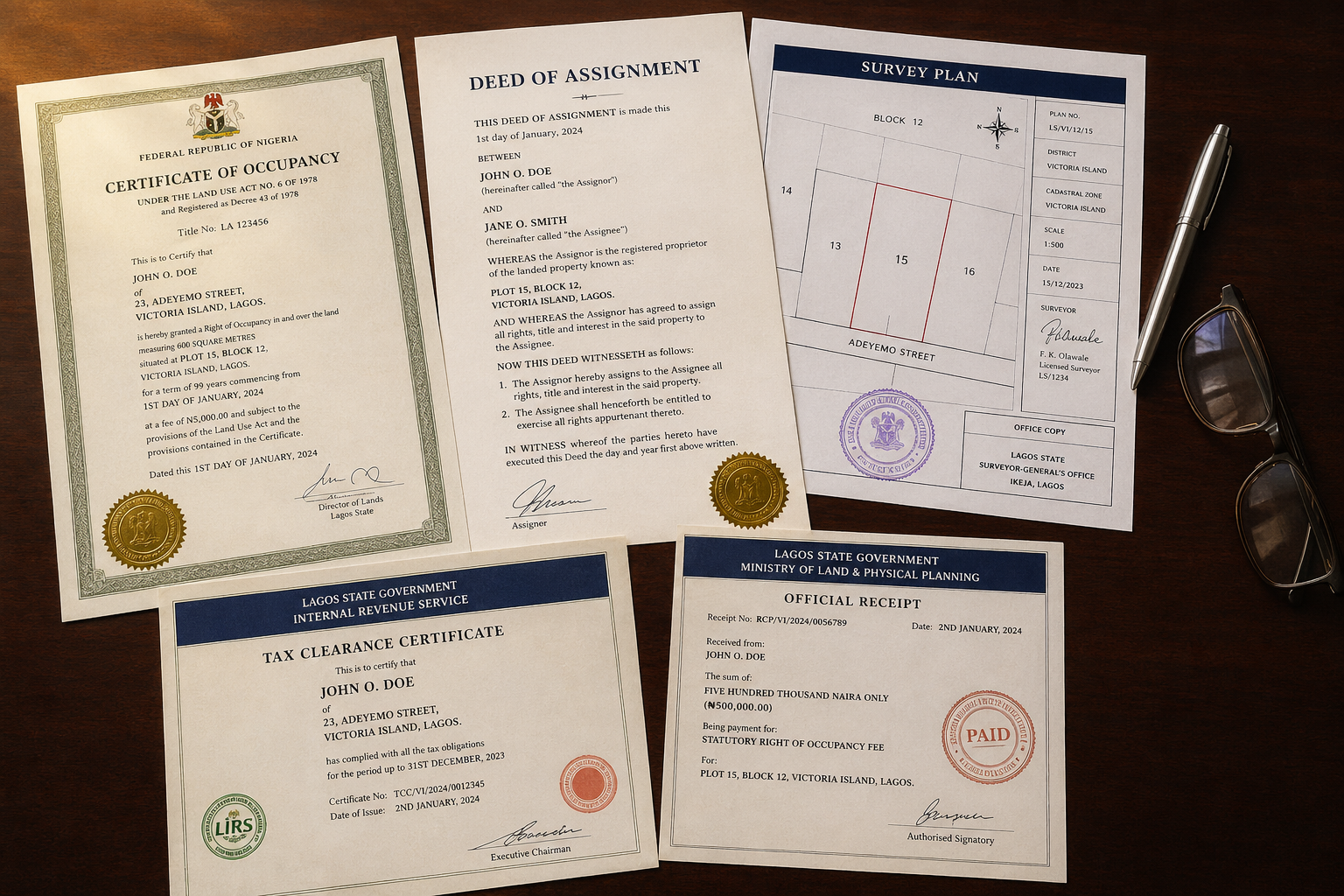
A survey plan is a document that provides a detailed description and layout of a piece of land. It is prepared by a registered surveyor and outlines the precise measurements, boundaries, and coordinates of the land in question.
Think of it as the blueprint of the land itself. It shows exactly where the land begins and ends, its dimensions, its geographical location, and critically, whether it falls within any government-designated acquisition zones.
Why It Matters More Than Most Buyers Realize
A survey plan will save you from enormous stress and prevent wastage of resources in buying land with wrong boundaries. Many lands are actually in places that the government will take over in the future. Those properties are designated as Committed or Under Government Acquisition. A properly commissioned survey reveals this before you spend a single naira.
Many buyers have lost investments because they purchased plots without verified survey plans. Having a proper survey is therefore not just a legal requirement but also a safeguard against fraud and future conflict.
What a Survey Plan Confirms
A legitimate survey plan tells you the exact size and shape of the land, confirms that the physical land on the ground matches the documents you have been shown, reveals whether the land falls under any government acquisition, identifies any encroachments or boundary overlaps with neighbouring plots, and provides coordinates that can be independently verified by any licensed surveyor.
The Legal Requirement
Before land can be registered and a Certificate of Occupancy can be issued, a survey plan is required. The Nigerian Land Use Act of 1978 mandates that a survey plan must be part of the documentation submitted for the issuance of land titles. Without it, your title processing cannot move forward.
How to Verify a Survey Plan Is Genuine
Fake survey plans are rampant, especially in areas with high land disputes. Always verify the plan with the Surveyor General's Office. Using an unregistered surveyor can lead to invalid or inaccurate plans.
Check that the survey plan carries the registered seal and SURCON number of the surveyor, the file number, the coordinates of the land, the surveyor's signature and date, and the stamp indicating whether the land is free from government acquisition. Any survey plan missing these elements should be treated with extreme caution.
Who Prepares It?
Only a licensed, registered surveyor can prepare a valid survey plan in Nigeria. The plan must then be submitted to and endorsed by the Surveyor General's Office of the relevant state before it carries full legal weight.
All Our Listings Are Survey-Verified
At Sardonyx Nigeria Limited, every property we list has a verified survey plan on file. Chat us on WhatsApp today to request full documentation details on any of our available plots.